Sunday, October 20, 2019

Passage, Surprise, What the Hell?

 Welcome to  another trip back in time. Yesterdays trip was to Ophir Utah located in Tooele County. Years ago, it had the recognition of being Utah's smallest town. It probably still is, but without having a mayor, it became unincorporated Tooele County. After the last mayor retired, no one wanted the job so it is now governed by the county. I do have to apologize, these fotos are from my archives. The half cab top doesn't allow easy access to the storage and I really didn't plan to write about this trip. I shall explain why in a few. The foto above shows the ore dump for a mine located 2000' up the mountain. The workers went in thru the tunnel here in town and took the ore elevators up to the actual mine. 
 The foto above is what is left of an old passenger train car. Time is taking it's toll on the poor thing and as of yesterday, it has pretty much collapsed into a pile of wood. What made me change my mind about writing was a sort of discovery of truth, for lack of a better phrase. Some of the properties have actual mines in their yards. For years I have watched an owner, who owns a lot in town, decorate his place around what I thought was a mine entrance. His property is mostly solid mountain. It is maybe 25 feet from the edge of the road to  a solid rock mountain with what looks like a mine.  
 As we were coming down from playing in a snow storm, we noticed that the cable was not hooked up and other people were walking around the property. We stopped and talked with this young couple for a few minutes to see if it was theirs. It wasn't. They were just curious too. They were looking for ghosts, literally. We began a conversation on graveyards in the area and where they were located. They moved on and we explored this interesting property. The foto above shows how upper management works.... 
 The owner has been decorating for Halloween and it was kinda fun to walk through. We headed to what appeared to be his mine entrance, stuck our heads past the decorations and literally hit a wall of rock. It seems our owner has made a fake mine entrance on his property. What the hell???? Here I have thought all these years that here was a mine a guy had in his back yard. How cool would that have been? But, apparently, it is just a decoration. So disappointed. We looked around further and then I saw something that surprised me.   
To the right of this fake mine is a brick wall. It is bigger than the fake mine and looking how it formed itself to the mountain, I believe he did have a mine entrance and he sealed it up. I'll never know for sure until I get lucky enough to meet the owner some future visit. I can understand why he sealed it.The first would be safety. Open mine are often tempting places to visit, and he didn't want any liability. The 2nd reason is a guess. I have read that some of the mines in Ophir had bad air in them. Unless you are carrying an oxygen meter, there would be a high chance of death. Remind me to get a detector. Snow is falling early this year. Not a lot of mountain visits left for they all become impassable. That's ok tho, We still have the desert to explore. Jeep on my friends!

Monday, September 2, 2019

GNU III, Naught a lot of Success

Day 3 dawned and after how bloody hot day 2 was I made a serious change of plans. Today was supposed to be my voyage into Nevada to find an old mining site named Atlanta. It is located approximately 90 miles from Milford with 2/3's being dirt road. 3 hours there, 3 back. The temp was 95 at noon Saturday and I honestly didn't wanna drive that long in that hot of weather. So, I guess a return trip is in order. So, I found another town on my list and headed west to find it. Shauntie was built on numerous mine claims in the area around 1870. Supposedly there was a processing mill there, post office, hotels and saloons. The town thrived until it burned down in 1876.  
 It was quickly rebuilt and lasted another year before the mines began to play out. As fast as it was built, it emptied out even quicker. A few mines were reopened in 1910 and produced low grade ore till around 1920. This time the exodus was permanent. Residents of Milford visited the old town and took everything they could  leaving concrete foundations and stuff they couldn't use.  
 What I found, which was not a lot, were some rock retaining walls, a couple of foundations, some wood piles and 1 mine. The GPS showed no mines and actually placed Shauntie on top of the ridge above the rock piles. Apparently there is not a road into the town. The area I found was very steep and rocky and I tried to find a way up to the top but I failed. I need to get on Google Earth and see what I can see  for the return trip. No mines showed up but as I was driving along dirt roads, I came across a fairly good sized one that I visited. 
 As I said before, this wasn't showing as a mine on my GPS so I have no idea what it was called. It was a good sized mine with the headframe still kind of standing over the entrance. Sorta, because it looks as if someone had pulled it out towards the tailings. The shaft was not strait down but on about a 60° angle. If my body wasn't so screwed up I could have entered this one with out a lot of difficulty. 
 I really should have brought my laptop with me but I have trust issues with hotel cleaners. My cell service was poor to nothing. I could not send out texts or calls for that matter but every once in a while a stray text would come through. I did have wifi at the hotel but trying to look at Google earth on my phone wasn't very easy. Needless to say, the laptop is coming on my next trip. 
Plus having it with me would have let me write these blogs the night they happened instead of a week later. After I left the mine, I followed just about every dirt road I could find looking for all this activity of the Shauntie area. I didn't find a thing. Well, that's a lie, I did encounter the herd of elk in the foto above. Now you would think with all the trips I take to the mountains I would have seen a million elk. Nope. This was the first herd of elk I have ever seen in the wild. I have seen a million deer, antelope, moose, but elk and bear have avoided me. Now its time to find the bear. Jeep on my friends!

GNU Day #2

 Day 2 of my vacation was the big one. It was going to be my return to Old Frisco. It had been 20+ years since I last trespassed there and I was anxious to see what changes had occurred. The first big change was the town gates were now locked, whereas in the past they were open. Glad I drive a Jeep.... anyway, this time I had unlimited space on my camera to shoot as much as i wanted. Last time involved my film camera and that would have been very expensive to shot as much as I wanted. My first stop there was the King David mine with its huge mine frame towering the area. That frame is old and has led an incredibly busy life.   
 The one ore cart is still in place as if to say lets get back to work. A co-member of a ghost town group sent me a link to his 3 part video on what is actually underground there. It was made in the same time frame of my first visit and is in black and white. Also, only part 2 had sound. It was still cool to watch and see what was left behind when they shut the place down. The shaft supposedly goes down 1200 feet but I could be wrong. All I know is that I would love to take a tour. 
 The old main dude house is still standing, for the most part. Time is waging a good battle with the house and has done some damage. But, it is still standing  as a tribute t quality work of time gone past. 
 The town itself is free to wander through without fear of being in trouble. This was my first visit to the town itself and not a lot of it is left. This stone edifice is the most complete of the town itself. Since it isn't behind locked gates it will get more visitors than the mine area. And more visitors means more vandals and thieves. They now have the kilns behind a fence. They are quite interesting to see.  

Next stop on the tour was the cemetery. Now in everything you read, it says that there were murders nightly. Like 10 a night. After observing the cemetery, I call bullshit. 10 x Frisco lifespan in days = way more than could fit in the cemetery. Its not small by any means, but here is the thing: there are family plots all over. And in these family plots are young children. I would say that 94% of the marked graves in Frisco are children. In  the foto below,
we find the grave site of young Hugh Sackett: born on January of 1901 and dying in July of the same year. 5 months and 2 days old. The place is full of markers just like this. I ran across what I think is an unnamed plot. that just had a few bricks laid out in a pattern. I may have missed some markers but again, the place is too small to have 10 murders a night. I believe a trip back to Frisco when it is cooler and you don't fry your body in the desert sun would allow for a more intense search of the cemetery and prove my theory.  
Sometimes out on my adventures I run into interesting people. The man above would be one such person. Now, forgive me because I have forgotten his name but my 45 minutes with him was a highlight of the trip. We shall call him Mr X. X is from California and drives longhaul for a living. His loads are carnival rides that go from town to town for county fairs and such. He had heard the story about 10 murders a night and had to come see for himself if it was true. We talked about historical periods and times as we walked among the grave sites. I believe he too is now convinced it is folk tale made up to add excitement to the old ghost town. He definitely falls into the good people of America category and I left there with a new friend. I have added more fotos to the Frisco Mine page plus I created a Frisco town page. More fotos can be found on those 2 pages. Jeep on my friends! 

Saturday, August 31, 2019

Gnu things you find in the desert

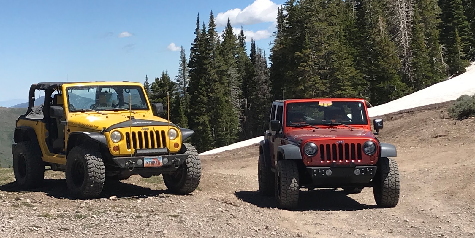
 I finally decided to go on a true vacation this year and I chose to head south to Beaver County to do some updates and find new things. I packed up Old Yellow and turned south and began a 4 day journey of fun, I hoped. First off I must say that I hate Blogger. I add fotos how I want them and it puts them where it wants to so we are out of order in events for day one. I could go in and delete it all and renumber the fotos but quite honestly I am too damn lazy to do that. My 2nd stop for the day was at Fort Deseret in Millard County. It was a fort built out of adobe by Mormon pioneers in 1865 when the war with Chief Black Heart broke out. 
 It is south of Delta on highway 257 and easily accessible. Since the military was fighting the Civil War at the time, the pioneers had to do what they could do on their own. If you have been there, you will notice that not a lot of trees grow in the area. Not a lot of anything grows in the area, but that's another story. With no trees to make a log fort, they made the whole fort out of adobe. Adobe is just mud and straw mixed together and it will dry to almost brick hard. Wikipedia states that the fort was 550 square feet. I'll estimate from actually seeing it that it is closer to 55000 square feet. Big difference. It apparently did the job and soon the war was over. There is no one there to talk to about it nor does it cost to get in. It is just a part of Utah's history that is still standing so of course I had to stop. 


My third visit of the day was the Maud-S mine just west of Milford. It is marked on my GPS and finding it was easy. It sits on a rise and has quite a bit of rock work as retaining walls and such. It is also wide open for exploration if you have the balls to go down the ladders. I did not. It is said that this hole is 160' straight down and then goes 1200' in tunnels. 
 There are 3 ladder entrances still open along with a caved in adit off to the side. I find this odd. I'll explain why in a minute. I did the proverbial toss a rock down the shaft and it took a while to hit bottom. I have no idea how long or far that old ladder goes down so there is no way in hell I would even try. Someday I would like to get a good wifi video camera I could hook to a rope and lower it into these places to see what I am missing as well as if it would be safe to enter. Until then i am outta luck. 
 The last visit of the day was a surprise. I crossed the little valley and picked a trail and followed it. My GPS did not show any mines but I found one at the end of this trail. Now, the Maud-S was accessible by pretty much any vehicle with ground clearance. This un-named mine was pretty much a 4x4 trail to get too and not on the map. Here is where I get confused. As you can see, the main tunnel is mortared shut. An additional adit above was gated. Now why would the government seal an unmarked mine that takes a lot of effort to get to and close it down when just across the valley lies a mapped mine with opening going down a long ways. I don't get it. 
 This wasn't a huge mine by any means, but I am sure with the tailings pile it was fairly decent in size. It had ore carts in it at one time and more than likely they are still there. The ties for the track are still in place and a few pieces of track were scattered about. Again, I just don't get it. 
 I guess Blogger wanted to save the best for last. It is also a controversial topic so keep that in mind. When Japan attacked Pearl Harbor and brought the USA into the war, it pissed people off. Think 9/11 and add much more anger. President Roosevelt signed an Executive Order, 9066 to be exact, and if you were Japanese, you were given orders to vacate the west coast and land yourself in a "relocation camp". One of the camps was located west of Delta Utah and called Topaz after the mountain to the west. Opened in September of '42, the population  of Topaz was nearly 9000 including staff. This made it the 5th largest town in Utah at the time. 
 Conditions there were dismal at best. The summers were hot as hell and winters were cold as hell. Yes it was hell. There were schools and hospitals, churches and gyms, but it still was a prison for the most part. Many of the detainees were allowed to leave during the day to work on local farms. Others volunteered to join the US forces and fight in Europe. In fact, the Japanese formed the 442 combat team and became the most decorated unit in the war. Still it was a prison for the most part. Not a lot is left. Visit my website to see more fotos but its truly a ghost town now. The 2 fotos above intrigue me. Whatever it is looks very new. But the area surrounding it looks undisturbed. Old or new? I couldn't tell you.  
So here is where it gets controversial. Was America right is forcing the Japanese out of their homes and ways of life and ditching them in the most God forsaken place on earth? Seriously, I saw 1 bunny. Nothing else moved. While there, they were given a chance to basically swear allegiance to the USA. Most did. 1447 refused and were sent to Tule Lake in California. Again, was it right? Germans and Italians were not forced out of their homes and lives like the Japanese were. They were singled out. Granted, to be a person of Asian decent after the attack on Pearl Harbor, you were definitely regarded with suspicion. I am sure I could look up and find where Asians had been beaten after the attack. We could say we were moving them for their own protection. But we were not. We moved them out of fear and distrust. A lot of them had been born here in America and never even been to Japan. That didn't stop Order 9066. What do you think?  Comment below.
Jeep on my friends.   

Saturday, July 6, 2019

Higher Than I Thought, Imagine That?


 Welcome to July in Utah, where our ski season just ended. Sadly, it wasn't in the Sheep Rock mountains where today's temp was hovering at 78, which really was nice. Today's adventure sent us to a canyon just west of Harker Canyon. North Oakbrush Creek is also known as Forest Road 090 and is another oasis in the desert. Though not as lush as Harker, It has some beautiful areas with huge pine trees. As you start up the canyon you can see the tram frame way up towards the top. You ask yourself, "how far of a hike will it be?" 
 Turns out that the road actually goes further up than the tram frame. The Hilltop Mine sits at 8600" and you can drive to the front door. Of course, this being Utah, the door was blasted shut so getting in it will be a problem. Knowing mines, I am sure there are some other places you could probably get in, but finding them would be damn near impossible. At this height on the mountain, the terrain is extremely steep. The guy who made this road back in the 20's had some balls up near the top. The view is incredible!
 This is I believe the main entrance to the Hilltop Mine. I guess if you really wanted in you could dig it out, but that would not be an easy project. The mine, from what I can find started out in the 1920's as a silver and lead mine. It is located in the Columbia District of Utah mine districts.  
 This foto has me puzzled. In 1928, a concentration plant for the refining of the ores was built. Could this be it? The thing that has me questioning it is a bed spring buried in the rubble. Was it  refinery or a house of some sort? I will have to do some more research on this subject. 
 Above the building, on the mountain is this funny thing. I am pretty sure its an ore bin for the refinery below it. I should swap the foto above for the one below but I'm too lazy so I'll just tell it how I see it. A year before the refinery was built, the mine installed an aerial tramway was built to aid with moving the ore. 
 The tramway ended, I believe here. It is right above the ore box below so it would use gravity to get the ore into the bin which would also use gravity to move the ore to the building below. Am I right???? I have no clue in hell. It makes sense tho. Also just a few yards away from the ore bin is a tram pole on the ground. At first I thought it was a building foundation but upon closer inspection I found it to be a pole for the tram. By the way, it was made from a huge piece of timber. A trail leads up an offshoot canyon so there might be even more to be explored. 
As we made are way down the canyon, exploring every road we came to, we found some cacti in full bloom. It is rare to see them flower, but a wet summer, which we have had, gets them to bloom and they are really pretty. Just don't try and pick one, it will be painful I promise. Jeep on my friends!

Sunday, June 23, 2019

How To Have the Perfect Workplace Meeting

 Welcome to a tutorial on how to have the perfect workplace meeting. To begin with, location of said meeting has to be perfect. For example, the tailings pile of the Hidden Treasure Mine located at the top of Dry Canyon. The area is large enough to accommodate all of the employees who attended this important gathering with room to spare. 
 As you can see, said tailings pile is huge. I would really love to know how many miles of tunnels created this perfect meeting spot. Now I am guessing just using my eyeballs but its got to be well over 600 feet in length and damn near 100 feet high. A ballpark guess on the width would be 35 feet. So, we have a perfect sized spot for a meeting and so the parts department met at 10:30 this morning for our weekly staff gathering. 
 The head honcho himself was there as well as the supervisor and their newest grunt, the Man in the Yellow Jeep, not to be confused with the Man in the Yellow Hat and a few extra personages who came along for the ride. 
 Now, even tho the meeting was held in the perfect spot, the material can sometimes be boring. When that happens, being in the perfect spot helps immensely. Your eyes can wander around the facility and sometimes you can catch a few good views. FYI, what you are seeing below is the Army Base used to destroy the deadly nerve gas bombs they had stockpiled. Back in the 90's, we sat on a cliff above this spot and watched them blow up 500-lb bombs. It was quite interesting to see a small mushroom cloud rise up to your level then hear and feel it a minute or so later. That would have been icing on the cake during today's meeting, but I do recall they kinda got into a wee bit of trouble for doing it so I don't think it ever happened again.   
 Nothing makes for a better meeting than a mini filed trip to someplace interesting and cool, literally. We took ours up the mountain another 2000 feet to the pass on top. We were thinking about exiting the meeting going out this back way, but due to a major snow spill by the Mother Nature department, that plan was canceled. Seems that the spill was still quite large and deep not allowing for a safe exit. So, we went out on the most modern exit and returned to our various places of home. Meetings like this need to happen more often, that's all I can say. Only fault for this one, someone forgot the damn donuts!
It's been a few weeks since I have been out playing in the back country and I really needed this trip. The weather was perfect, the company was good and it allowed my mind to clear. Visiting the great outdoors is an awesome form of therapy. In the foto above, where we were stopped by snow, the air was clear and you could smell the pine scent coming from the trees. It was kind of the pinnacle of the trip. We sat up there for about 45 minutes talking to some UTV guys the Head Honcho knew and no one wanted to leave. It was that nice. But as we all know, all things come to an end. Sad, but my attitude is better and I am ready for another week of work. Jeep on my friends!

Sunday, May 12, 2019

Gnats From HELL Really Bite, Literally

 The title says it all. OK, it really doesn't, but it is a true fact of life in Utah at this moment. Friday was the start of a 2 day jeep-concert-jeep trip to western Utah. The plan was simple. Jeep out to Wendover, rock and roll, then jeep back home. Sounds like a great idea. It. Was. Awesome. But, there was an issue the whole trip. We began at the Monarch Mine north of I-15 in Tooele County. I say north due to the fact there are 2 mines with the same name in the county. This trip we explored the area more in depth because we could. Last visit was during the winter and snow was everywhere. Friday, there was no snow but it was replaced by gnats. We opened the windows as we climbed up the mountain and before we knew what hit us, we were invaded on a mass scale by gnats. And they really wanted to make our day miserable. These little shits bit. And bit some more. They seemed to love our faces and we ended up closing the windows to save ourselves. When we reached the mines area and exited the vehicle, we were again under attack from the savages. It wasn't very fun!  We explored the area rather rapidly and soon moved on. 
 We crossed over the top and headed down to Marblehead. There were roads there I had wanted to follow and we ended up at the milk-can antenna. Some time in the past, this had been a high powered antenna for communication of some sort. Now, the can is filled with animal droppings and a couple of old switches. It has a really good view of the entire area and was worth the stop. I do wonder what it was used for and by whom. We finished by exploring another road to the top and again we were rewarded by spectacular views and of course, gnats. Now it was time to move on to Wendover. 
 On the bill for the evening was Grand Funk Railroad celebrating their 50th anniversary. 2 of the 3 originals still play with a new keyboardist and 2 new guitarists. Max Carl, pictured above wrote one of my favorite songs when he was with 38 Special. He was very friendly and answered a few questions for me on his time with them.
 The other guitarist is Bruce Kulick. I have seen him play years ago when he was playing lead for KISS. He was also kind enough to talk some KISS and get a foto with. I very rarely add fotos of myself in anything I do online, but this was the exception. The band kicked total ass and sounded awesome. They even threw in a surprise song that blew me away. Max wrote one of 38's number one songs and they played it that night. It wasn't my favorite but it was kinda cool. It was 80 minutes of good old kick ass rock and roll and they were great! Now, if they had only played my favorite song by 38 I would have called it the perfect show. Not to be rude, but I am thinking the average age there was between 65-70. What was scary was seeing these older farts acting like they were still 17, and some even dressed the part. One lady left a lasting impression that almost destroyed my eyesight. Note to self, do not wear spandex, fish net and leather when I am 70. 
 Saturday morning soon arrived and we were back on the road. South was our direction and Gold Hill was our first objective. Our first stop was the storage shed in the downtown district. Its contents are slowly disappearing over time but there are still hundreds of core samples located in the place on shelves. The samples are used to determine if there is ore in a specific area of the mine. The open box above shows typical samples from a certain area in a mine located nearby. I honestly don't know how they samples themselves are then tested, but they are kinda cool. I don't think I have seen an unbroken one out there in all my visits. 
 Standing at the front door I noticed that across the street was a saloon. In fact there were 3 buildings I had never noticed before. There were welcome signs out front but as the norm for Gold Hill, not a soul in sight. We walked up to the saloon and tried the door. It opened. There were no lights but it had the appearance of an old time saloon from the 1880's. The poker table above had real money on it. Seriously, there was money on the table. I was amazed. Someone is very trusting. There was even a notepad with names and what they had either won or lost. 
 Tending bar was none other than Donald Trump. Oh, and all those bottles you see are full. On the bar was a visitor sign in sheet. Of course we signed and I look back now and maybe I should have poured myself a shot for the road. There was also a huge John Wayne figure and a pool table. I could have spent a lot more time in there just checking out the antiques. It was amazing. Out side in front of building 2 was an air compressor with a note saying feel free to use it and just put it back when you are done. Building 3 looked like a store of some sort but it was locked and we couldn't get in. Wonder if it is an actual bar and they do sell drinks???  
 The trip now went east as we followed the Pony Express Trail. We stopped at a station to look around and came across Harold the Horny Toad. This was a time I wish I had a video recorder. This guy was interesting. He stopped where  you see him and froze. Shari picked a weed and began to scratch his back. He didn't run but he did go into his defense mode. The mode is frozen. She could put the weed under him and lift him off the ground. It was like he was petrified. They do that I am guessing to make themselves hard to swallow. I dunno. With all the horns and his killer tail, biting him probably wouldn't be pleasant. Since this was the first one I have ever seen, it was kinda cool to watch him. 
Further east in an area I wont mention the name of we ran into this mine. I am pretty damn sure it was a gold mine due to the fact it was basically an adit through pure quartz rock. It was pleasantly cool inside with no killer gnats and the roof was high enough to walk normal. It looked like it went on forever and I figure we were in 500 feet. Weird thing is, there really wasn't a tailings pile in front of it. Maybe it was used to bring ore out from a mine higher up on the mountain. I really don't know. I do know I have another reason to go back there and see where it goes and how far that is. We weren't really expecting to find something like this and we were a but unprepared. Next time! Look for all my fotos from this trip on my website and use the link above to get there. Jeep on my friends!

Saturday, April 20, 2019

Beyond Death and a Return!

 Buenos Dias and welcome to another boring trip report on my activities in the west desert of Utah. The sun was finally out yesterday so we knew it had to be taken advantage of. We had be scouring Google Earth Pro for mines and buildings we had yet to see. The better half came up with some good choices in the small canyon east of Death Canyon. I searched topo maps and Google to find a name for it and the only thing I could come up with was Finders Road. The map I was using was old so just go with its the next road going north after Death Canyon. As you can see by the fotos, we struck paydirt!
The first mine we hit was one we had to work for. Some older maps show a road, most modern do not. And, there is not a road, per se. I am just going to tell you all to figure it out for yourselves. As for a name of this mine, again I struck out. The only named mine in the area was the Bar X over in Death Canyon. The better half found this interesting box in the cabin. This side says .50 caliber with tracers. Then the sides say something totally different. I figure some one needed a box and found what they could to make it. The building itself was interesting. Two telephone poles used to build the head frame were at one time bolted to the floor. The ore was brought out of the mine on an inclined track and dumped behind the building. It would be nice to be able to see one of these systems in their glory actually working. It pulled up the cars on about a 75° angle. This little area has shafts all over and needs to be explored further.
 Above you can see Fred. He was kind enough to pose for a foto. This mine is so off the grid due to no real way to get there unless you hike, or own a Jeep, that this guy has probably never seen a human. The only hint I will give you is look east going up Finders Road or you will not see it at all. 
 Further up the road is another huge ass mine area. There are two huge tailings piles about 1/2 mile apart both accessible buy vehicle. Both mines have been blown shut so all you can see is the out buildings and homes that were left. The road does a loop at the end so by staying on it you will see both mines and all the houses. From evidence we found, the place either had generators or actual electricity. I found the cooling unit out of an ancient fridge and wanted to bring it home but it was a wee bit heavy and large. Maybe next time. Finders Road is fairly decent and unless it is wet most vehicles could go up there. There is a cabin someone owns in the canyon so I advise you to stay out of their property. 
 We finished that area and headed back to Death Canyon to visit the places we couldn't get to last trip. We did take 2 roads I had not taken previously. We were rewarded with some cool things. One was this stone house. Who ever built it had some smarts. Not only did he hand build it but he chose a spot with one hell of a view. You can see for miles from this house and I actually had cell service out of Delta. This house seems to be a popular place judging on the garbage people have left and the amount of empty casings, mostly .223. I would recommend a high clearance vehicle for this trail and stay off it if it is wet.  
To end this blog, I am going to add this marker. You can click on the foto to read it. I liked it due to the guys first name. I have heard of some weird names but Philander? 
phi·lan·der
/fəˈlandər/
verb
  1. (of a man) readily or frequently enter into casual sexual relationships with women.
  2. He was a soldier from New York I am thinking after doing some research on his name. So if it was him, he was soon headed back east to fight in the Civil War. I bet he caught a lot of shit for his name, or, maybe he lived up to it! If you want to see all the fotos from my trips, go to http://www.mtnmad.com/ Jeep on my friends!