Hello there and welcome to a non-Jeep blog. I hope you will enjoy this as much as the Jeeping blogs, but today was somewhat of a different adventure. The Union Pacific released a bit of news saying that their steamer 844 would be out on a run and would be passing through Box Elder County and stopping in Ogden overnight. We, the public, were invited to come check it out. So, naturally, I did. This is not the biggest of their steam engines, fact is, it's the smallest of the 3 surviving engines. But don't let that fool you. This thing is anything but small.

This particular train was delivered in 1944 for use on high speed passenger trains here in the west. It pulled some famous trains of the time including the Los Angeles Limited, Overland Limited and the Challenger. The news release gave out vital info of the train but left out the top speed. Lucky for us that the Union Station in Ogden has the younger brother of the 844 on display. According to that display, these trains would do 110 mph. That is a lot of speed. Oh, how much fun would it have been to ride on this train. Even better, how much fun would it have been to be the engineer?
Looking in the cab, there are 2 seats with controls in front of both seats. No one was hanging around to answer any questions so I can't say if you can drive from both sides. The bloody thing is so long that in order to see whats ahead of you, you would have to hang your head out the windows quite a ways.
As you can see, there are a ton of valves and gauges and levers and....... looks damn complicated to me. But you have to admit.... it would be a pleasure to learn how to run this thing. A few people up here took their drones out and captured it coming down the tracks. It is so impressive. If you click on the link above to my web page, you can go from there to my youtube page and watch a video of the Union Pacific's 3985 Challenger I took 20 years ago. Oh hell, lets just add the link here. https://www.youtube.com/watch?v=z4c_ym9f7pE
This thing is big. I am standing on the platform looking down on the guy. The wheels on this beast are 80" high. The overall length oh the engine and tender is just over 114'. The combined weight is 454 tons. The engine is powerful. To get that much weight plus a host of passenger cars up to 110 miles per hour..... wow!
With all the moving parts associated with getting the power to the track, the train requires a ton of upkeep. Every moving joint has to be greased often. The fotos don't show just how many grease spots there are or how much grease is flung everywhere.
The connecting rods here above have got to be strong as anything and probably weight over a ton a piece. Just out of the foto there are two mechanics working on something that required their attention. An interesting sight, not included in these fotos was that one of the cars it was pulling was a mobile machine shop. There was a welder, a small crane and a metal lathe all set up and ready to run. I guess when what your driving hasn't been made in over 60 years you have to learn how to make it on the fly. Its not like you can go to your local CarQuest store and by a new part.
The tender of 844 is huge. It holds 23,500 gallons of water and 6200 gallons of fuel oil. For this trip, there was actually a second tender coupled behind the original to keep it fueled and watered. With the diesel engine replacing the steam engine, water stops are few and far between anymore. It would be quite interesting to run out of fuel or water on a good will trip like this one.
This last foto is one about the American way of doing things. If you click on the foto and look at it up close you will see that there are rivets everywhere. This engine was built in a time of true manpower. Each one of those rivets was placed there by a man or woman who took pride in their job. These things were not built on an assembly line by robots. They were built by American men and women by hand in an age long past. Their commitment to quality still shows today. This train is awesome! Jeep on my friends.
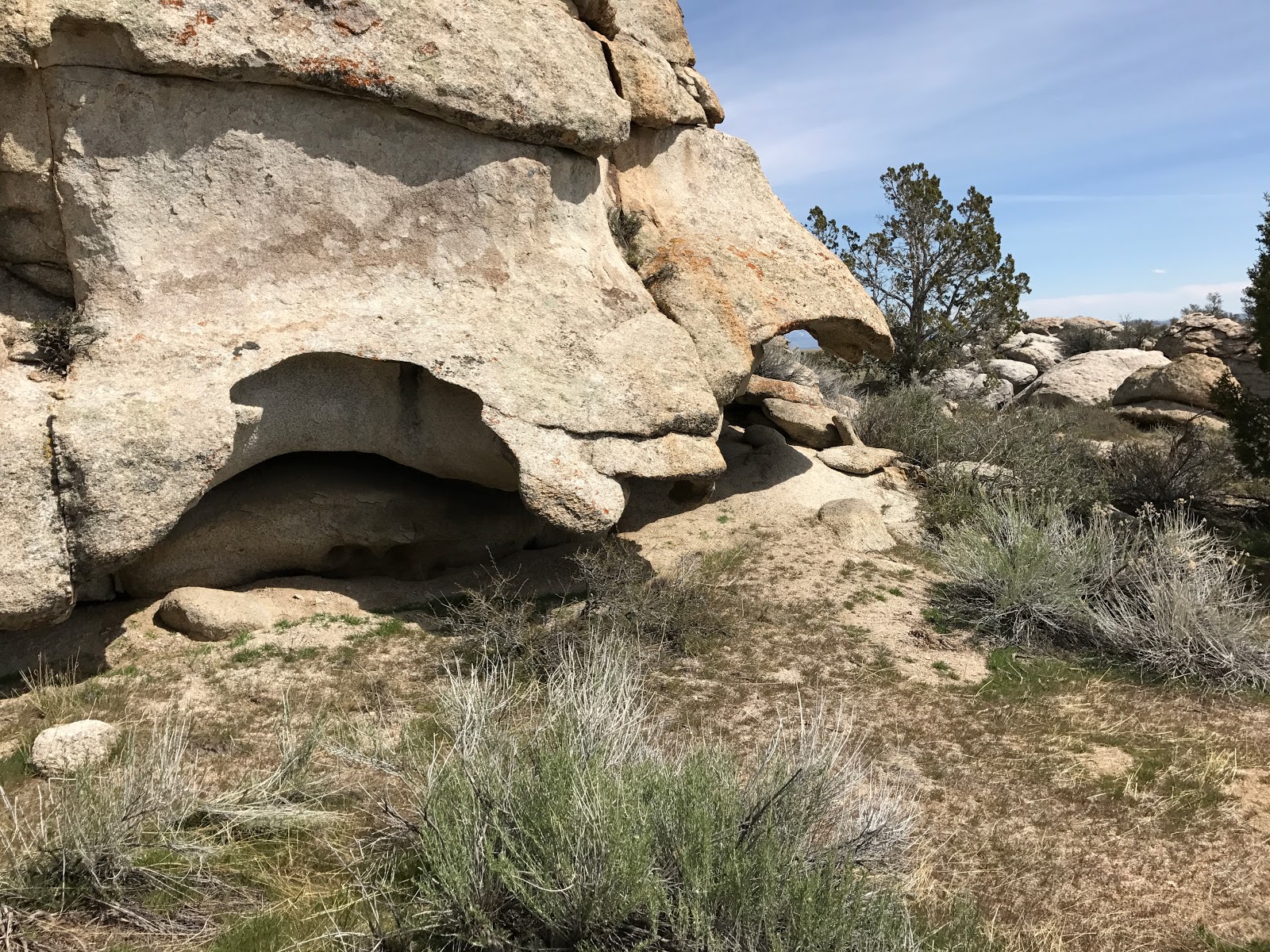
Welcome to another adventure out to the wild west desert of Utah. The Devil's Playground is full of unique geological formations. I am thinking that the name came from the fact that it is hotter than Hell out there in the summer and the fact that the formations are truly bizarre. Young Wyatt, a nephew, is glancing up into the odd shaped cavity of the rock. If you go back a few years, and I think it was on my Yahoo blog, there is the same foto except its Samantha and she is stuck up in the top. I dared Wyatt to climb up into it but then I remembered that he is accident prone so I withdrew my offer.
Throughout the whole area, there are formations that leave you wondering how they came to pass. The above foto shows how weird they can be. How long did it take to erode away the rock to leave this type of result? The area is notoriously dry so it can't be from any running source of water. This leaves us with rain and wind and snow. The big question is how long did it take, and what determined the odd shapes?

Back to the first foto. If you enlarge it on your screen, you will notice 2 distinct cobblestone patterns going up the rock. What's really odd is the fact that it is on the front, and then goes inside the hollowed out part and its also on the "roof" for lack of a better word. This cobblestone pattern is all over the place out there. I have pointed it out before in previous blogs, but the fact that it is there is mind blowing. You can actually see on some of the formations that the rocks in the cobblestone look like they were placed there with careful thought, almost as if they were a cobblestone street at one time. Hundreds of rocks, laid with precision. It is mind blowing.

I took our guests to one of the mines that is out there. This one was worked in the 70's and still has a lot of junk laying around. I did not do very well in planning this quick trip. Well, I did but I planned wrong. With all the rain we have had and how it was 2 weeks ago out there I figured we wouldn't even be able to make it up to the mine. I was wrong. So, being wrong led to me not bringing my good flashlights. No good flashlight means you can't go into the mine and explore. Damnit. I guess I will just have to break down and buy a really good one and just leave it in the Jeep. I have been in this mine before, but due to physical issues I didn't make it very far. Oh well, I guess that just means I will have to go back and do it again. Sux to be me, Not!
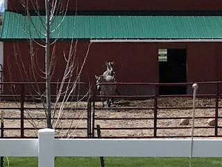
To finish the trip, I took Wyatt to persons house who has way too much money. As you can see, these are not your usual horses you would find in most barns of the west. In fact, you probably would only find this somewhere deep in the African Savannah. Why have a good Quarter Horse when you can own a pair of Zebras. To each his own, I guess. Jeep on my friends.
Welcome to the first real adventure of 2017. Spring and winter have been fighting over who should be visiting at this time and today winter threw a few good punches with a dusting of snow below 6000 feet and a ton of rain for everywhere else. This battle has been going on for over a month. We have had temps in the 70's and below freezing all in the same week. Welcome to Utah. I decided to hit the trail today regardless of what Mother Nature decided to and enjoy it come what may. I was joined by Kirt and we left home and headed west, right into the storm. As we motored out to the Devil's Playground, we encountered a very weak rainfall and by the time we got to Snowville, there was sun. The puddles in the road let me know it had rained and the snow level was down lower than it had been in weeks.

As we started off road going west into the playground, the road became somewhat of a mud festival. I hardly had any traction and there were mud holes everywhere. Some were fairly deep and they made the ride so much fun. We finally made it to the area and got out and took some fotos. I know most of you have seen my previous posts and fotos I've taken of the area, but who cares. Some might not have seen them so here they are.
As you can see, the little yellow Jeep got quite a bit of mud on it, but it never had a problem. Fact of the matter is that I only used 4 wheel drive on one really nasty section of the road. For the rest of the trip it was strictly 2 wheel drive and a lot throttle. It was a blast. I am almost sad that I didn't take the GOPRO out with me this time, but, we would have had to clean it every 20 feet. Oh well, not a big deal. You all will just have to take my word on it that is was a blast, and only the beginning.
We crossed over the mountain using the same pass that the early pioneers used on their way to California. Emigrant pass is part of the old trail that persons heading to California used on their long trek across the desert. We followed it till it hit the main road then went west to the Lucin area.
Now, before I go on, I must explain that we have had a ton of moisture this year. So much so that there has been a lot of flooding going on. At Lucin, a flood of water came down through the area and wiped out an important section of track. The "water" ran through a culvert 7 feet in diameter and until this year, it worked perfect. As you can see, there is no culvert to be seen. All of the snow and rain made for a hell of a flood and wiped it out. The interesting thing is that there is still water running from mountains down through this area. I have never seen water running through this area yet there is now a 25 yard "riverbed" complete with a tiny river.

Another oddity is the fact that the pond at Lucin is damn near bone dry. There is a tiny puddle but that's about it. The government sign says that the pond receives the water from a pipeline to the north. With all the water we have had, I can't quite figure out why its dry. Who knows, maybe the feeder pipeline has broken or been destroyed by the major flood. Again, no idea.
Next stop on the tour was the Sun Tunnels. They sit in the middle of nowhere on a very fine layer of sand. The road to them was freakin' slippery and being alone I chose not to get close to them. If you get stuck out there it would be a long wait for someone to come pull you out. After leaving the Sun Tunnels, we headed south on the road to Wendover Utah. I have never been down this road so it was all new to me.

As it was like the roads before, this road too was a fun, mud bogging adventure. Some parts were dry while other parts were a mud bogger's dream. The little yellow Jeep had no problems going through all this mud and before we knew it, we were at Interstate 80 and Wendover, Utah. The sign above tells how the emigrant trail system went through the area we were driving through. The road we followed damn near matches the route they had taken. This area of Utah and the west desert is full of history form days gone passed. I can't imagine how it would have been to be driving a covered wagon on my way to California. I will say that, today, was a great day to be out there exploring. We did see some roads that need to be explored in the future so we will be back. We did a late lunch in Wendover before heading back home. On our way home though, Mother Nature let loose with the rain and hail. From Samantha's house to back home here in Tremonton, the skies opened up and rain came down by the buckets. So much so that it washed the Jeep, which sucks because a dirty Jeep is a great Jeep!
Jeep on my friends!
Welcome to a new blog and a new year. This years Jeeping activities will be beginning later than usual due to an excessive amount of snow here in northern Utah. For the most part, our area up in Box Elder County usually doesn't get a high amount of snow. Well, at least not in the last 20 years or more. This year seems to be the year of exception. We have received more snow this year than the rest of the state. I traveled to Salt Lake this past weekend and the ground is bare. As you can see, my yard still has a ton of snow left even though it has been raining. With the warmer temps that come with rain, the snow is melting and this vast amount of water has nowhere to go. Thus the title, Spring Flooding. I did add the question mark because its only February. According to the weather people, our biggest snowfall months are February and March, so this could only be the beginning.

This foto shows the newest lake in Tremonton. The Malad River is usually a quiet little body of water just barely bigger than a stream. Not this week. As you can see, it has gone over the banks and turned this field that usually has horses in it to a small lake.
Over the hill in Cache Valley, the Little Bear River is over flowing too. I know the fotos are not my best work but if you look closely, you can see the docks and parking area are under water here too. Plus, look at the mountains in the background. They still are covered in snow that has to melt. I am thinking there will be a part 2.
The Little Bear feed into the Bear River and it they meet at Cutler Dam. With so much water already the officials have opened up the spillway to ease the pressure on the dam. There have been some washouts so going back into the area is now prohibited. Rumor has it that even some parts of the Union Pacific tracks have been victimized by the water and caused some major problems. On the trip to Salt Lake I did notice that there were a lot of trains on the lines stopped not going anywhere.

Downstream from the dam the Bear is flooding over its banks. This is just like Lake Tremonton. The valley has the Bear running through it, but good luck in finding the river or the valley under this water. There is a small local playhouse located in this valley and from what I could see, its damn near flooded itself. Besides the areas around the rivers, many houses in town are starting to get water in their basements. The last I heard was only 2 stores had any pumps left to sell, kinda like a month ago when you couldn't find a snowblower to save your life. I am hoping that this is only a one part story but only time will tell. I do know this though, I am tired of winter and I really want to get out and continue exploring the roads no one travels. Jeep on my friends.
Hello again, and welcome back to my adventures. As you can see by the title, this one wasn't quite as successful as I had wanted it to be. Oh well, all part of life I suppose. Day one, the only success of three, had us back in the Park Valley Mining District to finish up the trails and see what else was there. Our first discovery was that someone is actually mining the area. As you can see above, he has his tunnel locked up so no one can go in. He also has cabin and storage garage nearby. There was some signs of ore carts used, but I'm thinking he isn't using them now. I would really love to go and take a tour of what he has going on in there.

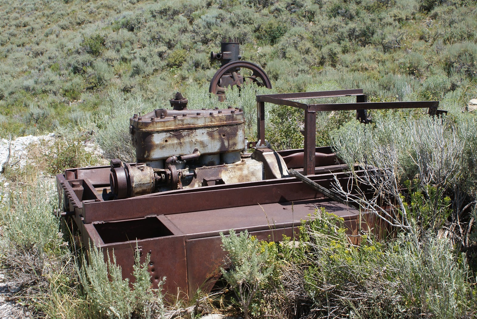
We continued up the mountain and came across this old engine. It is very old and I couldn't see any manufacture markings on it. It ran, and I am pretty sure I am right, the machine below. It has 4 cylinders and judging by its design, I am thinking it had a ton of power. The cylinder walls are huge so I am guessing it was designed to run machinery and not your mama's Desoto. This would be a fun project to return to running condition. I'll be damned tho as how to get it off the mountain.
This apparatus was run by the above engine. I am not 100% sure as to what it is exactly so I will keep quiet on it till I know for sure. I do know it was made by the Fairbanks Morse company and they are still in business. I just put in a call to them so when they confirm my guess, I'll add a note to this blog.

If you are my friend on Facebook, you saw the 3 houses in the cul-de-sac. Even tho there were 3 houses, they shared a common shitter. As you can see, its a genuine 2 holer and its not in working condition at the moment. I don't know how long it has been on its back, but I'm guessing a few years minimum. Now I know this sounds gross, but had I had the time, I would have dug where it once stood. Back then, when you threw away your garbage, you chucked it down the shitter. The human waste is long gone. The garbage on the other hand could still be there. Lots of people have dug up all sorts of things including coins where the outhouse once stood. Who knows, maybe I'll head back and try my luck.

After we finished the PVMD, we went north and west into Idaho to the town of Twin Falls. Emily wanted to see the "falls" so we went there. Shoshone Falls is quite spectacular. The river is low so we didn't get the full effect, but what was running is always pretty. Early spring is the best due to the runoff. The foto above is the most awesome part of the whole area at this time. It would be really cool if you could somehow get closer to it.

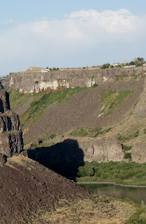
The Perrine Bridge at Twin Falls is a sight to see. It spans the Snake River Gorge as almost a work of art. It is 1500 feet across and 486 feet above the river. Perhaps the most unique feature of the bridge is the fact that it is LEGAL to base jump and bungee cord jump off of. In the past I have seen it done, but as our luck would have it, no one did while we were there. Base jumping I get. Bungee cord..... oh hell no! It might be a rush to someone to see that river coming strait at you and suddenly bounce back just before it happens, but not to me. Just imagining it gives me the willies. With my luck I would not only meet the river, but I would probably meet the bottom of it too.
In the top left side of the foto above, there is a mound of dirt climbing from level ground up, as to form a type of ramp. This is what is left of the Evel Knievel stunt of jumping the Snake River Canyon. On September 8th, 1974, Knievel attempted to jump the canyon using a steam powered rocket. The parachute deployed prematurely and even tho he made it across, the wind pushed the rocket back into the canyon where it landed on the rivers edge. Rumor has it his son wants to do it himself somewhere in the near future.
The next two days of said trip were the strikes. We headed into Nevada to search out some new old mining areas and didn't find one. We got permission to cross the San Jacinto Ranch property to begin our quest and it went to hell from there on. Though we did see some cool things, we took no fotos. I got on Google Earth and retraced our tracks and we missed by a mile. So, it now appears that we will have to do it again. Sux to be me! Jeep on my friends.
Continuing on our journey, we took to the road and went east. At this point it must be said that Birch Creek road now becomes East Vipont road. Why it does that, I don't know, it just does! Following the trail we came upon a massive stamp mill long since abandoned. According to research, this mill was able to process 200 tons of ore a day. The foto does not do its size nor the steepness any justice. The place is huge and being as it worked on gravity, its built on a very steep hillside.
All around the place are leftover relics from days gone by. As you pass through the sagebrush you must constantly watch where you place your feet as to not step on something sharp or jagged and ruin your day. The above foto shows a type of chute that material traveled down to another level.
We thought that the mine was above the mill but it is said that it was a dumping point for a tram. The ore was brought down and stockpiled to be ran through the mill as soon as it could.
What amazes me the most is how well these old places were built. The boards above are somewhere near 100 years old and they remain intact after such a long time. Other items spotted were good old fashioned iron pipes that could still be used today. Yes they were rusty, but they were still as solid as the day they were made.

Honestly, the barrel above could be 10 years old but I am thinking its way older. The iron cone was used to funnel something somewhere and could still be used today. Hell, the cement walls on the place are almost a foot thick. They built the foundation of this place to last. I sure wish the rest of it had been built that way. A stamp mill is such a cool thing. It functions almost like an engine. It has crankshafts connected to iron hammers that continuously move up and down smashing ore to dust. I can only imagine how loud it must have been. On YouTube, you can watch some demonstrations of tiny mills that have been preserved or rebuilt. These small units are very noisy so one can only imagine a whole buildings worth.

The mine we were looking for we did not find. Well, we did kind of, but not really. Our objective was the Phelan tunnel and we did find that. Well, what is left of it. According to an old engineering journal, the Phelan tunnel was built to aid in taking ore out of the main mine itself. The tunnel was to be 2000 feet strait in. At that point, they would start digging up and down and tie into the vein of the main mine. By doing this, they anticipated making extracting the ore much easier and had an idea to install a tram way down to the mill or a small steam powered train. As to what happened???? Who Knows. There are no signs of a tram or rail bed. This mine would be fun to explore too, but alas, there is no way in from where we were.
I was standing on the tailings at this point looking back towards the tiny trail to get up to it. The slope is so steep that they are barely 40 feet wide at the top.
The view looking down is scary. It is well over 500 feet almost strait down. One slip and away you will go. According to the GPS, the road ended just a ways up the canyon at a dead end. Looking on Google Earth you notice that it doesn't end and there are more mines in the area. Needless to say, we will be back out there soon to do some more exploring. I can't wait. Jeep on my friends!
Last years adventure to the 3 corner area of Utah, Idaho and Nevada brought the discovery of another mining district in that area. The area is or was home to the Park Valley mining district. At that time, we were out of time to explore so it got put off until now, well yesterday actually, but you get the idea. The trip started at 8:00 am sharp and we headed west into the unknown. Our last trip 2 weeks ago to the area was rained out and it looked pretty certain to do the same today. The rain followed us to Snowville then disappeared for the day. We crossed into Idaho and went east on Birch Creek road. Well, it was muddy as hell and with not a lot of options, we retired back to the main road. I then decided to try the original road we tried 2 weeks ago and see how it went. It hasn't been driven on for ages, but it wasn't a mud-fest like the main road.

We headed east and the adventure began. Our first surprises of the day were the old army truck above as well as Mr. Snake, who was asleep under the door that had fallen off. I wonder how an old military truck ended up out in BFE? There isn't much left of it and the ID plates had all corroded away to nothing so we were unable to even tell what year it was. Someone must have wanted parts off of it years ago because it is basically cut in half behind the cab. I went on Google Earth last night and you can actually see this truck if you know what to look for. As I have said, this trail is pretty much unused. There are spot where it disappears and you have to guess where to go. This led to some kick ass wheeling until we finally arrived back on Birch Creek road. The area where they merge was perfect and we again headed east to our first stop, the Peg Leg mine.

The turn off to the Peg Leg is easy to miss. Thank heavens for the GPS. The road is barely visible and even then it looks like a hiking trail. We turned onto the trail and followed it for a bit. By this time we had crossed back into Utah and we headed north until we hit the border fence. The road dog legged east and wound down a slight draw to the mine site. I would be willing to bet that the entrance to said mine is in Utah, but the treasure was under Idaho. To our extreme disappointment, there wasn't much of anything left. The entrances, as you can see by these 2 fotos are caved in.

I am willing to give odds that there are still ore carts buried under the mountain. We did find some old track in the debris pile so I'm thinking there could be some carts in there somewhere. Like the mine in the Devils Playground area, this mine is also up a trail where trying to take some sort of tractor to dig it out would be damn near impossible. You know, I really want an old ore cart. They look so cool sitting out in front of houses and I might even be tempted to plant flowers in one......... maybe.

Once we finished exploring that area, we left the Peg Leg and headed on to another mine on the map. Before we could get to it, this old cabin appeared on the hillside and it was just begging to be explored. We followed the trail up the hill and wound our way to the old site. Not a lot of people visit this cabin I am thinking. The sage brush around it was 4 feet high and even the trail was overgrown. It is a large cabin and considering it has to be over 100 years old, it's in fairly good shape. As we explored the GPS kicked out the name of this mine area as the Dolly Clark mine. For reasons I have yet to discover, this mine is not in the Park Valley district but in the Ashcroft Mining district. The mine produced silver in some quantity before its demise.

Research on the Dolly Clark has led to nothing. It was a silver mine but that's about it. Some surveys say it is an underground mine and inaccessible due to water. I have no idea on the water issue. I am still not far enough along to go hiking steep mountains so this one will have to wait to be explored further. So far the day had been been great. We did some gnarly kick-ass Jeepin' and found 2 new mines. What would the rest of the day bring???? Jeep on my friends!